Slovenia's Ultimate Loop: Vršič and Mangart in a Day
113 kilometres, 2,944 metres, two countries and the two highest roads in Slovenia. Over Vršič, down the Soča, up Mangart, out through Italy and home. There is no better day on a bike here, and no version of it that's easy.

This is Slovenia’s ultimate loop. If you ride one day here, ride this one.
Kranjska Gora → Vršič → Trenta → Bovec → Log pod Mangartom → Strmec → Mangart → Predel → Tarvisio → Kranjska Gora.
You climb the highest pass in the country, descend beside the Soča for thirty kilometres, ride up the highest road in the country, cross into Italy over a border pass, and come home on an old railway line. Two great alpine roads, two countries, and you finish where you started.
There’s a particular thing that happens on a day this size. Somewhere on the second climb the noise stops — the emails, the plans, the running commentary — and what’s left is the road, the gradient and the sound of your own breathing. Riders come back from this loop quieter than they left. That’s the actual reason to ride it. The numbers are just how you explain it to people afterwards.
The numbers
113 km · 2,944 m · two passes · two countries
| Leg | ||
|---|---|---|
| Kranjska Gora → Vršič | 12.0 km | +825 m |
| Vršič → Bovec | 32.8 km | mostly down |
| Bovec → the Mangart turn-off | 13.2 km | +512 m |
| Mangart, out and back | 22.5 km | +1,206 m |
| Rejoin the main road → Predel pass | 3.0 km | +60 m |
| Predel → Tarvisio | 12.5 km | down |
| Tarvisio → Kranjska Gora | 17.3 km | +162 m |

The profile tells you the shape of the day: a sharp peak at kilometre 12, a long flat valley through the middle, then a much bigger peak at kilometre 71. The second climb is where the day is decided.
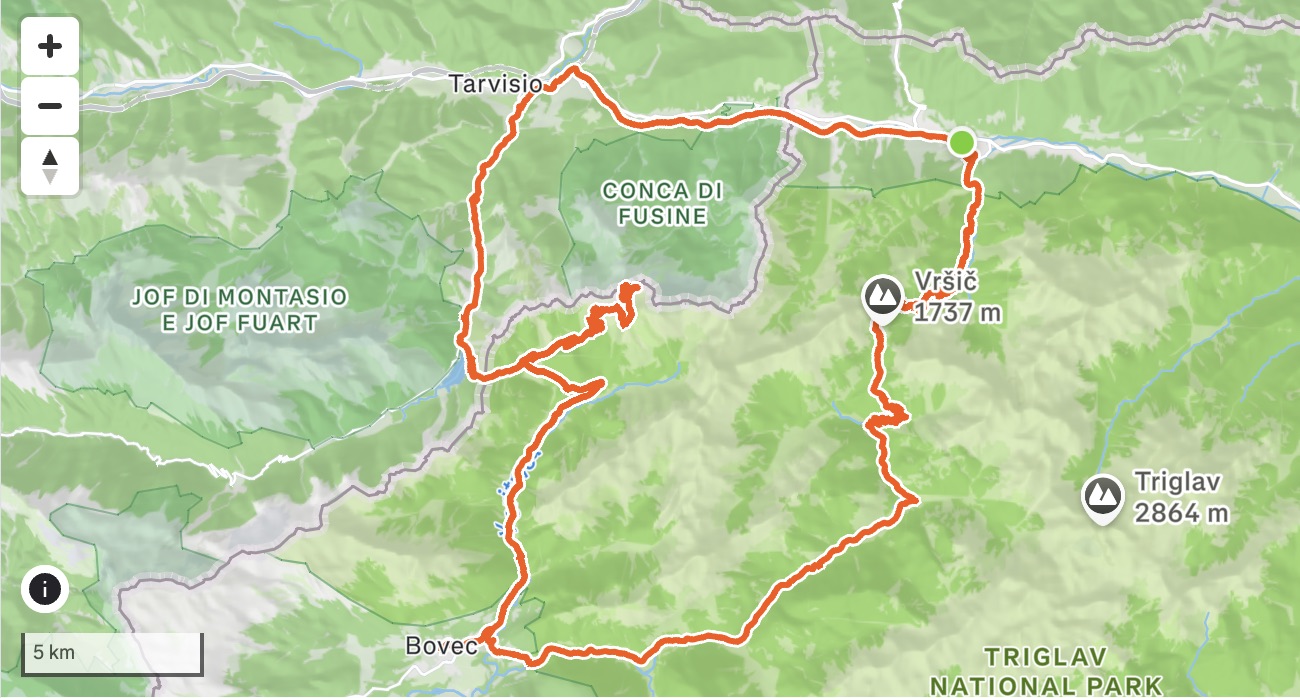
One number that isn’t in the table and should be: from Bovec to the Mangart saddle is 24 kilometres of almost unbroken climbing, and 1,570 metres of it. It doesn’t feel like a climb when you leave town. It becomes one.
Before you go
Lights, and not optional. There are five tunnels on the Mangart road, each roughly 100 to 200 metres long, and they’re properly dark. The floor inside is gravel, not tarmac — so you’re braking and steering on a loose surface with your eyes still adjusting. Front and rear light, in daylight, in August. Slow down going in.
Take a layer more than you think. The Vršič descent is long and it’s cold even on a warm day, and the Mangart saddle sits at 2,055 metres where the weather changes without asking. A packable jacket, not a gilet.
The Mangart road has a toll — but only for cars and motorbikes. Cycling it is free, and there’s a better consequence than that: the parking at the top fills up early, and once it’s full the road closes to motor vehicles for most of the day. Which means the highest road in Slovenia is frequently a road with almost nothing on it but bikes.
Carry a passport or ID card. You cross into Italy at Predel and back near Rateče. Both are open Schengen crossings, but carry it.
Season. Vršič is normally open from spring through to December. Mangart is shorter — roughly June to November, closed all winter. The overlap is your window.
Leg 1 · Kranjska Gora to Vršič
12.0 km · +825 m · 6.5% average · to 1,611 m
The warm-up is short. The road leaves Kranjska Gora and starts climbing almost immediately, twenty-four hairpins to the top, several of them stone-paved through the corner.
The road was resurfaced in 2026 and it’s a noticeably better ride for it — the broken sections are gone and the whole climb is more enjoyable than it has been in years.
It was cut across the mountain in 1915 by Russian prisoners of war, working through a winter at altitude. An avalanche in March 1916 buried a work camp near the top; over the following two years 106 prisoners and 18 guards died on this mountain. The wooden chapel the survivors built stands beside the road and you pass it climbing. In 2006 the upper section was formally named the Russian Road.
It’s worth stopping. Most people ride past it at kilometre eight with their head down.
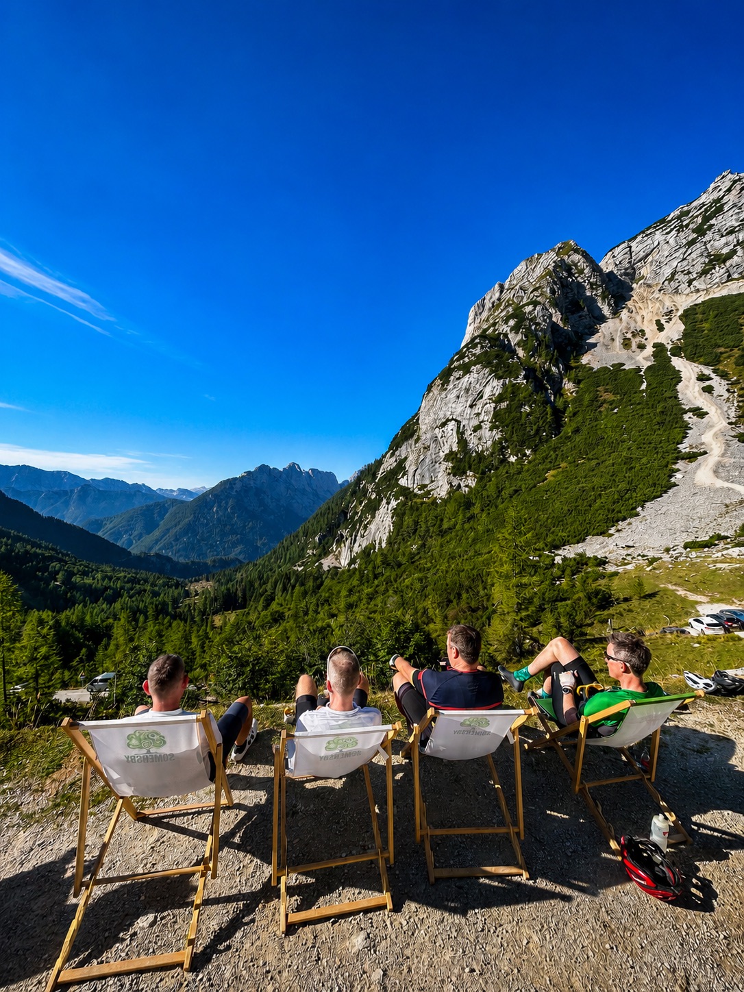
Where to stop: Erjavčeva koča comes up before the summit and it’s a good hut, but hold on. Stop at Tičarjev dom, at the top of the pass — coffee, food, water, and the view south into the Soča valley you’re about to drop into. That’s the one worth fifteen minutes.
Leg 2 · Vršič to Bovec
32.8 km · twenty-six hairpins, then thirty kilometres beside a river
The Trenta side is a different road — smoother, more open, and it drops for a long time. Take it carefully in the wet; the shaded corners hold water.
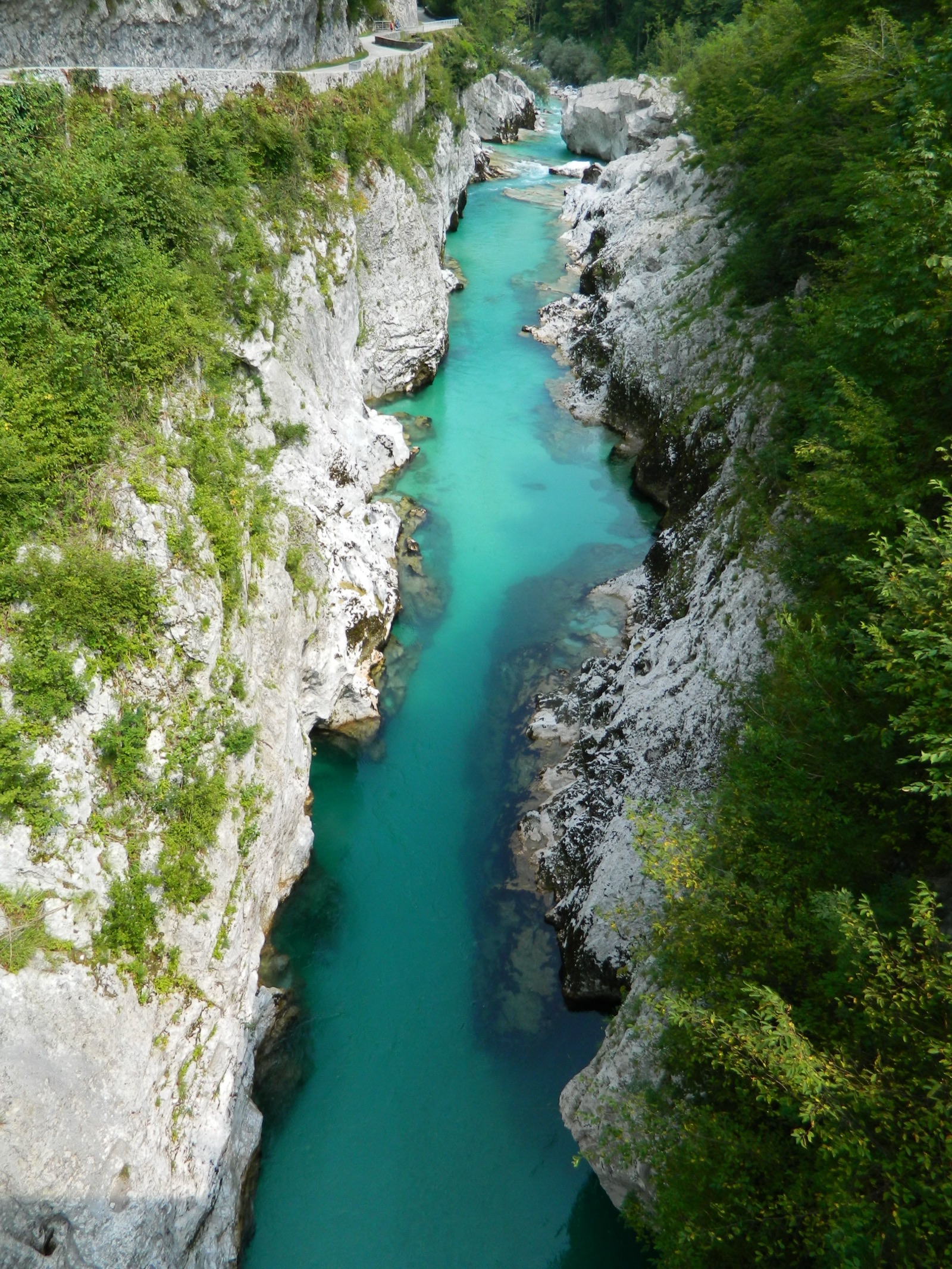
Then the valley opens and the Soča appears, and the rest of this leg is one of the great river roads in Europe.
The colour is the thing nobody believes until they see it. Not blue, not green — a hard mineral turquoise that stays with you for thirty kilometres and shifts with the light and the depth of the water. It’s a glacial river running over white limestone, and photographs consistently fail at it.
Two things on the way down:
- Izvir Soče — the source of the river, a short walk up from the road at the top of the valley
- Velika korita — the Great Gorge, where the whole river squeezes into a limestone slot a couple of metres wide.
Then a fast, gently falling valley road into Bovec.
Leg 3 · Bovec, and the last water
13.2 km · +512 m to the turn-off — and this is where the day starts properly
Bovec is your last proper food stop. Eat here, properly, and don’t skip it because you feel fine. There’s a supermarket, and there’s one café worth planning the day around.
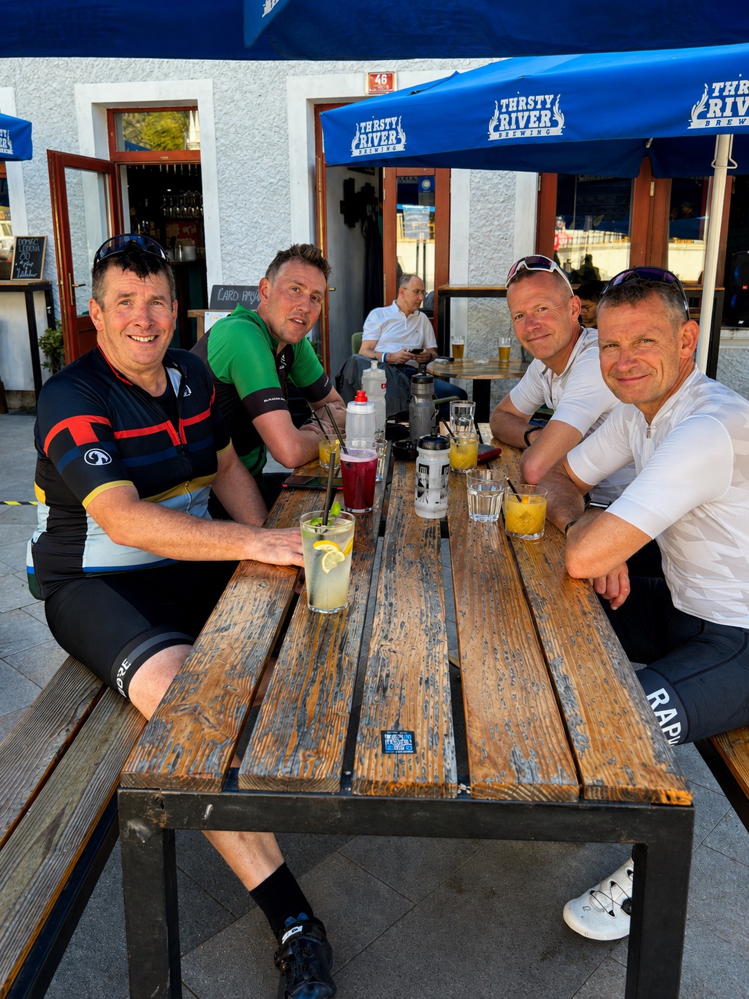
Thirsty River — go for the savoury croissants. Rogljiči with local prosciutto, cheese and rocket. There’s nothing quite like them on this side of the Alps, and it’s why we build the stop into the day rather than treating it as a top-up.
Out of town the road turns up the Koritnica valley toward the Predel border. You ride under Kluže Fortress, an Austro-Hungarian fort wedged into the gorge above the river — the road passes directly beneath it.
Log pod Mangartom has water, and cafés if you need them.
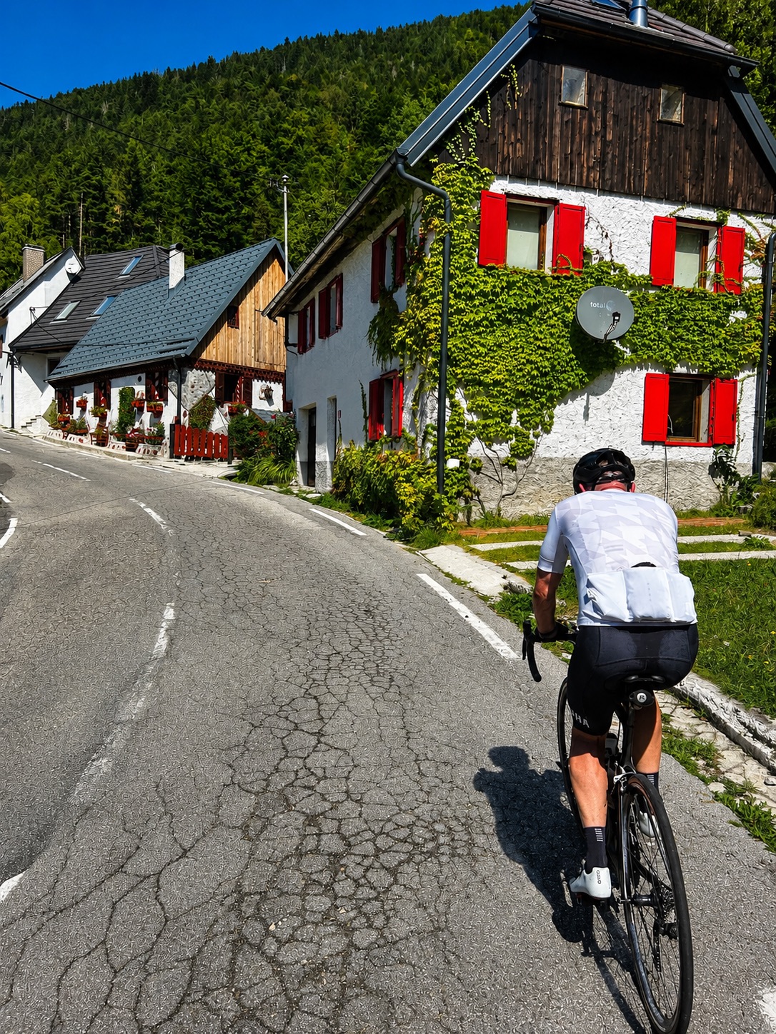
Then Strmec na Predelu, and this is the part to know. The steepest pitch of the whole valley section is right here in the village — and on the left-hand side there’s a spring.
Fill everything. This is the last water before the top of Mangart and the last water until you’re back down and over into Italy. There is none on the climb and none at the saddle.
Just past the village, after the viaduct at Pri Mlinču, the Mangart road branches right.
Leg 4 · Mangart
About 12 km from the turn-off · 22.5 km and +1,206 m out and back · to 2,055 m
The highest road in Slovenia, cut into the mountain face in the late 1930s.
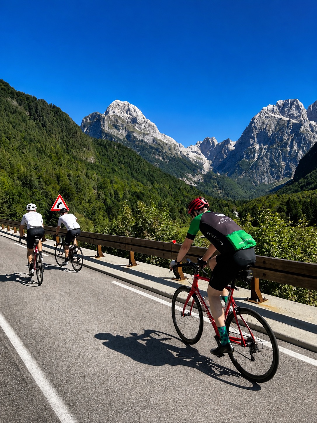
It starts in forest, and for the first few kilometres it’s an ordinary alpine climb — trees both sides, switchbacks, the river dropping away behind you. Seventeen curves. Five dark tunnels with gravel underfoot, and coming out of one into full sun is its own small event.
Then the trees stop.
Everything above Mangart Pasture at 1,307 metres is exposed. The road narrows to a ledge pinned against the mountain, rock galleries overhead, the Koritnica valley a long way below on your right. There’s nothing to hide behind and nothing to look at except where you are.
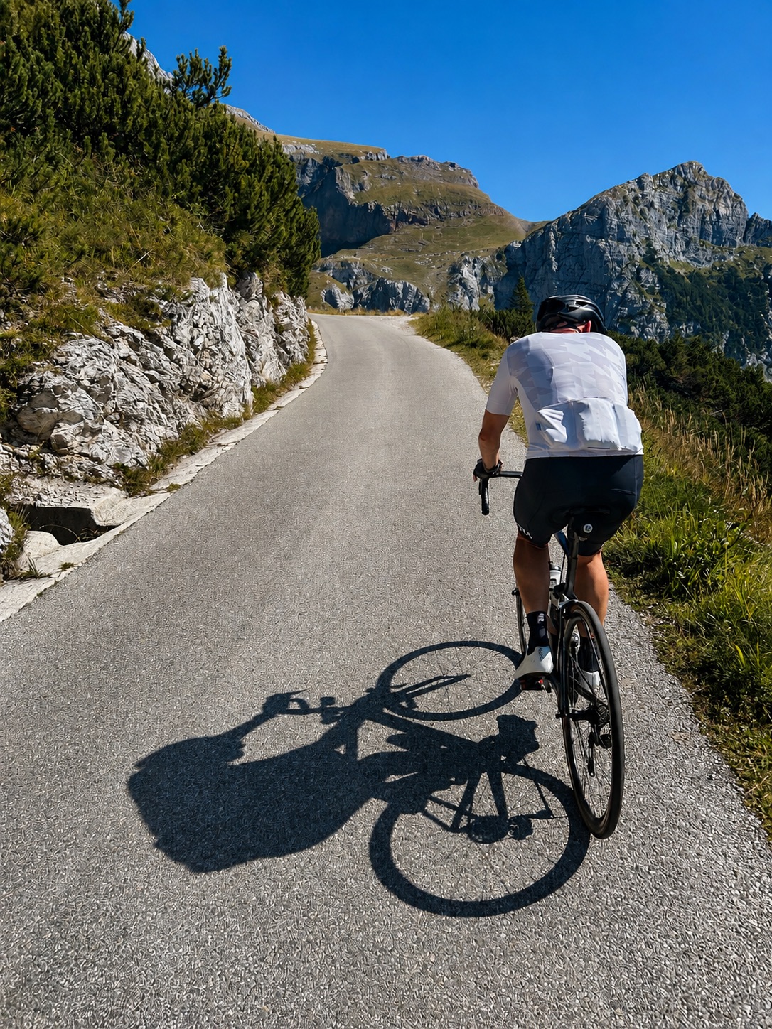
This is also where it gets steep. The hardest kilometre averages 13.9%, and there’s a five-hundred-metre stretch at 17.4%. Those aren’t estimates, they’re off the file. A 34 on the front and a 34 on the back is not excessive here, and you’ll be at 2,000 metres with 70 kilometres already in your legs.
The last section is closed to cars and motorbikes — motorcyclists have to lift their machines over the ramp. You ride around it, and from there to the saddle the road is yours. It’s also the section to concentrate on: rockfall puts stones on the road up here, some of them big enough to matter. Fine on the way up at climbing speed. On the way down, take it easy and watch the surface rather than the view.
At the top you’re at 2,055 metres on the Italian border, with the western Julian Alps in front of you and Mangart itself — 2,678 metres, the fourth-highest peak in Slovenia — standing directly above.
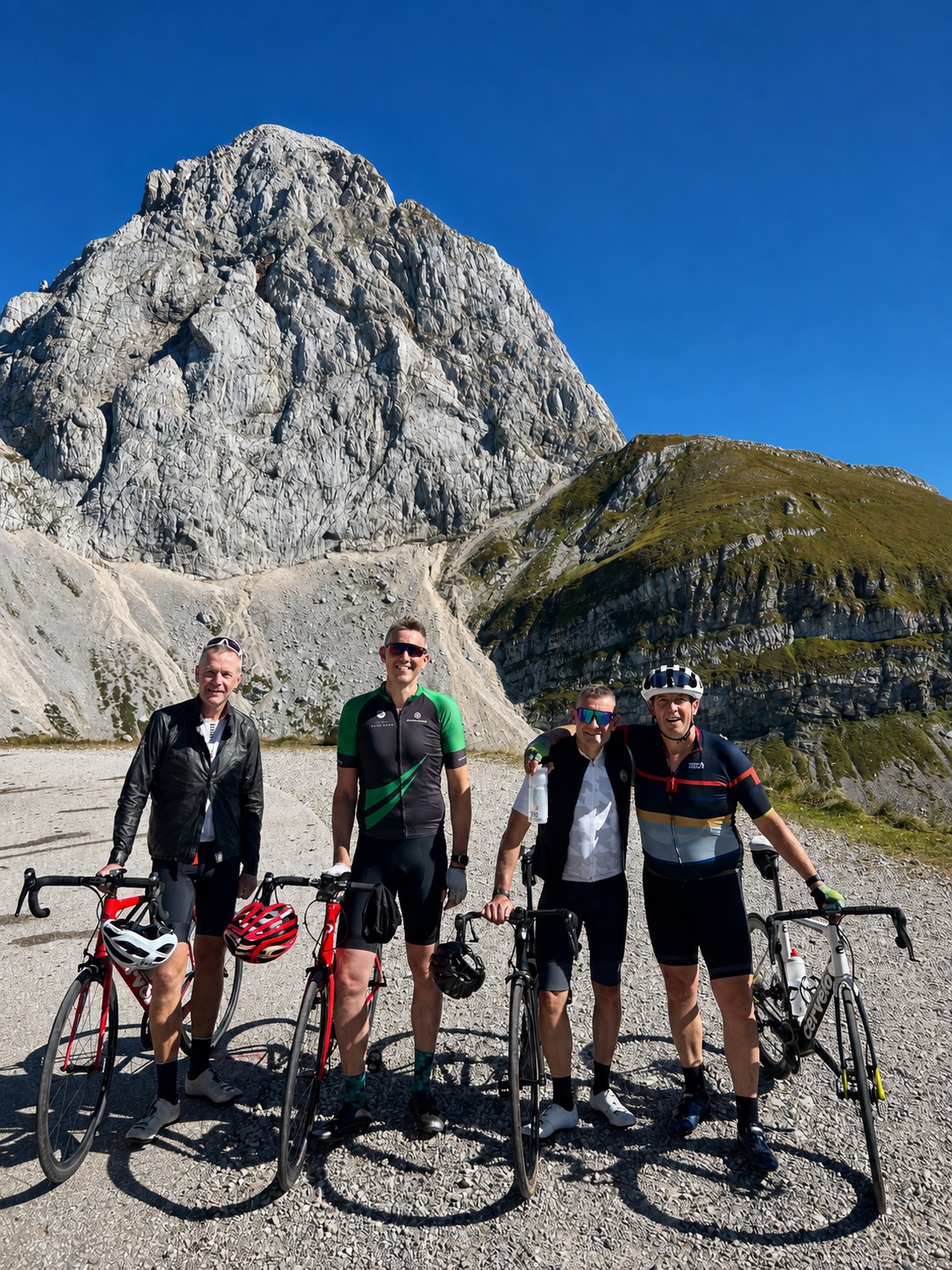
It’s quiet up there. Quiet in a way that’s hard to arrange deliberately. Riders who know the high roads of the Pyrenees tend to reach for that comparison, and it’s a fair one — the same narrowness, the same sense that the road is a guest on the mountain rather than the other way round.
There’s no water and no food on this climb. Whatever you filled up with in Strmec is what you have.
How long it takes. The Strava time is around 35 minutes and it belongs to Pogačar. You are not going to do that. A fit group takes an hour to an hour and three-quarters, sometimes two. Build the day around that number, not the one on the leaderboard.
Then you come back down the same way.
Leg 5 · Predel, and into Italy
3 km up to 1,156 m — and then 12.5 km down into Italy
At the bottom of the Mangart road you rejoin the main road and turn right — you don’t go back through Strmec. It’s a short pull from there to the Predel pass at 1,156 metres and the Italian border.
A kilometre later everything looks different. Different signage, different road markings, a completely different valley.
The descent runs past Lago del Predil, a deep green lake under the mountains. Chalet Al Lago sits above it with the best view of the day’s second half, and if anyone needs a proper sit-down after Mangart, have it here.
If you’d rather keep rolling, the first water on the Italian side is at the cemetery in Cave del Predil, right at the entrance to the village. Cave del Predil itself is an old lead and zinc mining town that feels like it stopped somewhere around 1970 — worth slowing through even if you don’t stop.
Then down into Tarvisio, one of the most genuinely intact alpine towns in Italy. Not a resort built for visitors — a working border town that happens to be beautiful.
Coffee: Bar Kirchenwirt Macoratti. Slow drip straight from the machine, and it’s the best coffee for a very long way in any direction. You’ve climbed two mountains and crossed a border to get here. Sit down for it.
Leg 6 · Tarvisio home
17.3 km · +162 m · the easy bit, and it’s beautiful
From Tarvisio you pick up the Ciclovia Alpe Adria — an old railway line converted to a cycle path. Gentle gradients, viaducts, and a completely different way of moving through mountains after a day spent climbing them.
It’s cycle path the whole way back to Kranjska Gora. No road sections, no tunnels, no traffic. After the day you’ve had, that matters more than it sounds.
Two things worth the detour if there’s anything left:
- Zelenci — ten minutes off the route on foot. An emerald spring pool where the Sava Dolinka comes out of the ground, on the edge of Triglav National Park. Astonishing, and most people ride past without knowing it’s there.
- Planica — five minutes off the route by bike. The biggest ski-flying hill in the world, where the world record has been set, and where Primož Roglič was jumping before he ever raced a bike. Standing at the bottom of it explains something about him.
Then a few kilometres down the valley through Podkoren to Kranjska Gora.
Where the water is
The most useful section on this page, and the reason people get into trouble on this loop.
| Point | Water | Food |
|---|---|---|
| Kranjska Gora | Yes | Yes |
| Vršič — Tičarjev dom, at the top | Yes | Yes |
| Trenta — spring just before Kal-Koritnica, at the foot of a small rise | Yes | Restaurants in the valley if needed |
| Bovec | Yes | Yes — the proper stop. Eat here. |
| Log pod Mangartom | Yes | Yes |
| Strmec na Predelu — spring on the left | Yes — last resupply. Fill everything. | No |
| Mangart road and saddle | None | None |
| Lago del Predil / Cave del Predil | Yes | Yes |
| Tarvisio | Yes | Yes |
| Rateče | Yes | Yes |
Two bottles isn’t enough for the Mangart section in summer — the Koritnica valley gets genuinely hot and there is no shade at all above the treeline. Carry three, and carry your own food: energy bars and electrolytes, enough for two hours with nothing available.
And sunscreen. Four hours of climbing at altitude with no cover is how people come home burnt from a day they enjoyed.
Shorter versions
Not everyone should ride the whole thing, and there’s nothing wrong with the smaller version.
Vršič and back. Twelve kilometres up, twelve down, home for lunch. The classic half-day, and still one of the best climbs in the Alps.
Vršič to Most na Soči, then the train. Over the pass, down the entire length of the Soča, and on to Most na Soči — where you put the bike on the train to Jesenice and ride the last stretch back to Kranjska Gora. All the descending and the best of the river, no second mountain, and the train through the Bohinj tunnel is a small event in itself.
Mangart from Bovec. Twenty-four kilometres of climbing and 1,570 metres. A full day on its own, and arguably the better of the two climbs.
Riding it with us
This is what we do, and it never gets old. We’ve ridden this loop more times than we can count and we still come back surprised every time — at the colour of the river, at how quiet it is above the treeline, at how good that coffee in Tarvisio tastes after seven hours.
You can absolutely ride it alone. The GPX is right there. But there’s a version of this day that’s better than the one you’ll build yourself.
- We know where the water is, which on this route is not a small thing.
- We time it so you’re on Mangart when the road is closed to cars and the light is right, and off the descent before the afternoon weather arrives.
- We’ve watched the road all season — what the tunnels are like, where the rockfall has come down, which huts are open.
- We can put a van where a van needs to be. At Strmec with cold drinks, at the top of Vršič for anyone who’s had enough, or carrying the jackets so nobody rides 113 kilometres with a shell stuffed in a jersey pocket.
- And we know the stops. Not the ones on the map — the ones that make the day.
Ride it with us and it will be one of the best days you’ve had on a bike. That isn’t a sales line. It’s just what this loop does to people.
Building a Slovenia trip for your clients? Here’s how we work with tour operators →
Get the GPX
Leave your email and the file's yours — plus first look when the next Home Road goes up.
Thanks — here's your file.
Download GPX